Tropical Storm Gordon, the seventh named storm of what’s predicted to be an extremely active 2024 Atlantic hurricane season, formed Friday morning far out in the open ocean.
As of 9 p.m. ET Friday, the storm was just over 2,400 miles from the U.S. East Coast and is moving to the west-northwest at 10 mph.
The official forecast track from the National Hurricane Center shows Gordon slowly meandering west across the open Atlantic for the next few days, potentially even weakening to a tropical depression.
Beyond that, most computer models show the system curving out to sea away from North America.
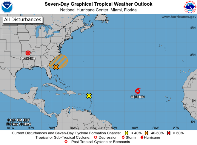
Meanwhile, Francine weakened to a post-tropical cyclone but was still a dangerous storm pounding heavy rain across portions of the Southeast and Tennessee Valley.
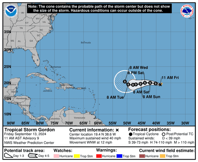
Where is Tropical Storm Gordon?
At 5 p.m. EDT Friday, the center of Tropical Storm Gordon was located about 1,045 miles west-northwest of the Cabo Verde Islands. Maximum sustained winds were near 40 mph.
The storm is moving toward the west-northwest near 12 mph. A turn westward is forecast by later tonight, with the system slowing down through the weekend.
Slight strengthening is expected today before a weakening trend begins on Saturday, the hurricane center said.
Gordon is the seventh named storm of the season
Gordon is the seventh named storm of the season. If it becomes a hurricane, which is not yet predicted, it would be the fifth hurricane of the season, joining Beryl, Debby, Ernesto and Francine.
It’s also only the second named storm to form since Aug 12. The last time that the Atlantic had only one named storm formation between Aug. 13 and Sept. 12 was 1997, according to Colorado State University hurricane researcher Phil Klotzbach.
A typical year sees 14 named storms, of which 7 spin into hurricanes; some predictions for this year were calling for as many as 33 named storms.
Tropical Storm Gordon spaghetti models
Hello, Helene?
In addition to Gordon, forecasters were also watching an area of disturbed weather closer to home, just off the U.S. Southeast coast, for potential tropical or subtropical development next week.
“In a few days, a non-tropical area of low pressure could form along a residual frontal boundary a few hundred miles off the southeastern U.S. coastline,” the National Hurricane Center said in an online forecast released Friday.
“Thereafter, some subtropical or tropical development is possible during the early part of next week while the system drifts to the north or northwest,” the hurricane center said.
If it gets a name, it would be called Helene.
One other disturbance is also spinning out in the open Atlantic, but only has a near 0% chance for development, the hurricane center said Friday.